Hiking
| Route 66 | Cities | Beaches |
| National Parks
Hiking |
|
| Getting There | Lodging | Restaurants | Natural Features | Hiking | Backpacking | Horsepacking | Fishing | Going Home |
Yellowstone is a hiker's park. Spectacular as are the sights you can see from your vehicle, or along a mile or two boardwalk, the park's real treasures lay several miles back from the roads. There's enough hiking here to occupy you for a lifetime of two week vacations. And it's not difficult hiking. Temperatures are usually in the 70s or low 80s. There's no humidity. There are very few steep climbs or difficult scrambling. There's water everywhere so with a good purification kit you need not carry more than two bottles. The trails are not crowded and good lunch stops are plentiful. If you're new to hiking there are guide services which will be happy to provide you with a knowledgeable mentor. Even veteran hikers hire guides for their experience with the Bison, Wolves and Grizzlies, or for shuttles to and from trailheads. We've chosen seven hikes for someone coming to the park for two weeks, one week seeing the features we list on our "Features" page, and one week hiking. |
.jpeg) |
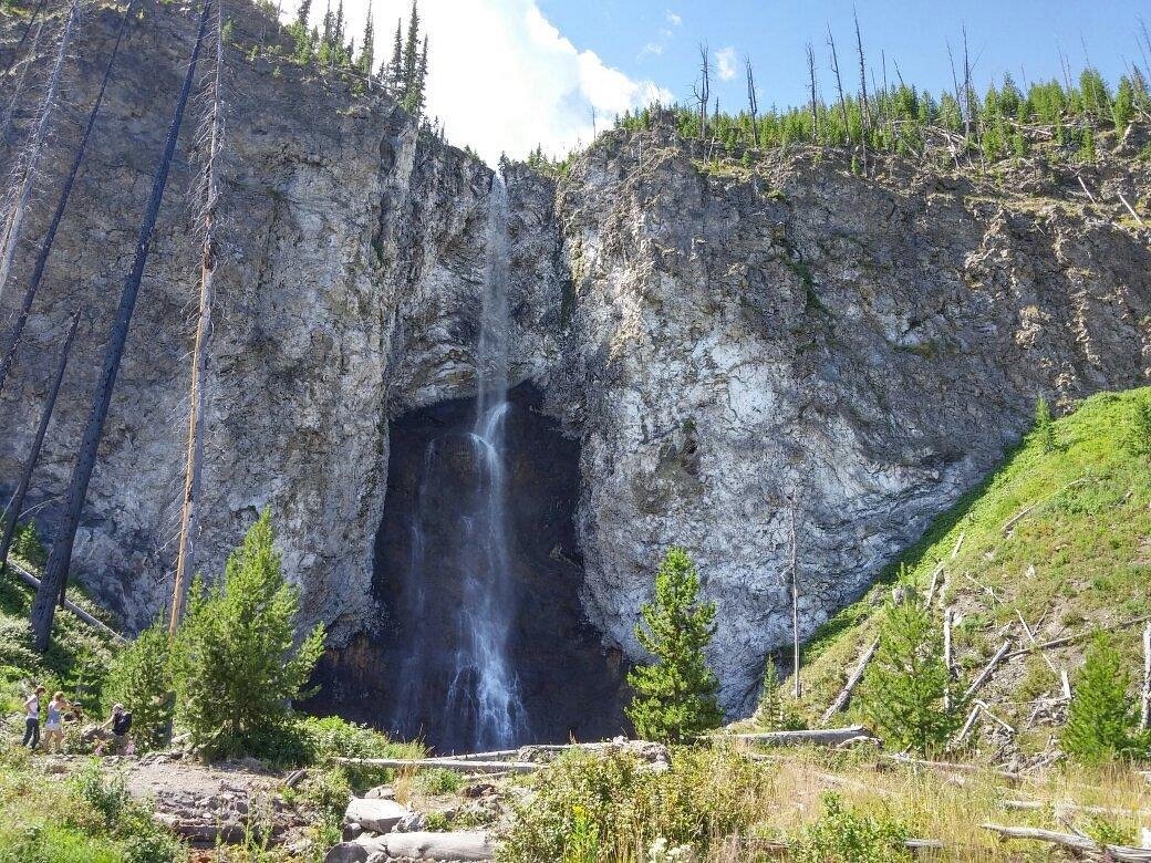 |
Fairy Falls. This is our favorite hike in the park because you get two spectacular scenes and have the option to add two more with a little further distance. Fairy Falls, 197 feet high, is seen in the photo at left. This photo is taken in late Summer so the flow is reduced but in May and June or after a day's rain it's much heavier and spectacular. This Falls is 1.7 miles from the trailhead. But halfway in, you pass the overlook where we took the photo of Prismatic Spring seen on our Features page. The hike is worth it just for that overlook. Most people stop at Fairy Falls, then hike the 1.7 miles back. But you can hike 0.6 miles further to Spray and Imperial Geysers, which will give you a hike out of 2.3 miles, 4.6 miles total. Imperial Geyser is really pretty but erupts infrequently. Spray Geyser erupts frequently but in a spray instead of a plume. The trailhead is a small parking lot one mile south of Prismatic Spring parking lot on Grand Loop Road. |
Our second favorite hike in the park is Mt. Washburn. It's a 10, 219 ft. mountain, but you can cheat the altitude by beginning your hike at 8859 feet Dunraven Pass (on the Grand Loop Road). So you only climb 1360 feet over 3.1 miles. The trail is actually a park service road, but it's blocked off to the public. At the top is a fire tower, drinking fountain, visitor center, rest rooms and a 20x telescope. The round trip is 6.2 miles. You can see for 50 miles 360 degrees including the Tetons far south. You'll encounter Bighorn Sheep, with a herd living up here, and you may encounter Grizzlies. They take over the mountain in September when they're devouring the heavy crop of whitebark pine nuts. The trail is officially closed during September. There is no water at all on the way up so you'll need two bottles, but you can refill them at the drinking fountain at the visitor center. A jacket is advised, as it's usually cool and windy on top. |
|
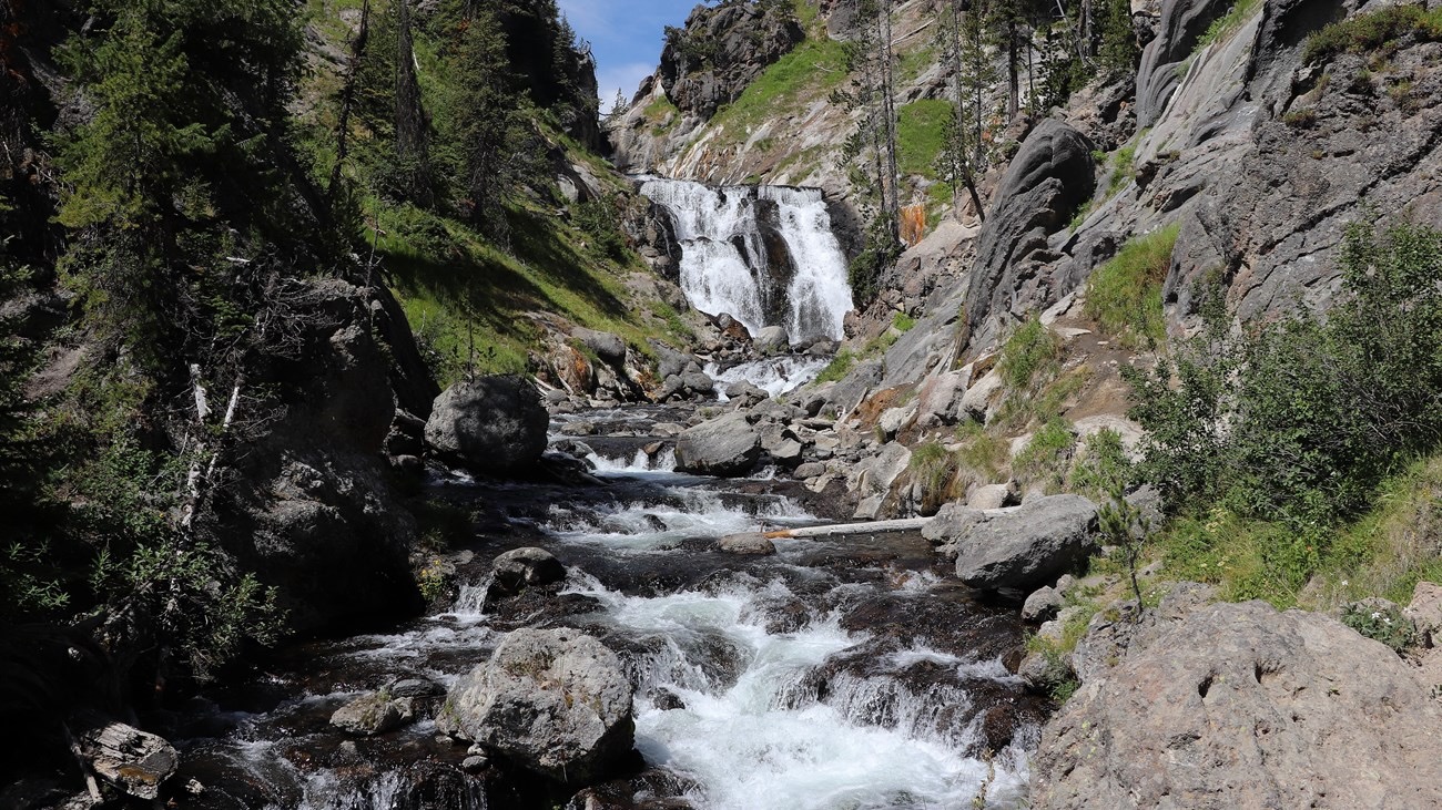 |
Mystic Falls is a hike you can make directly from Old Faithful Inn. Go to the Upper Geyser Basin boardwalk, turn left (away from Old Faithful Geyser), and hike north to the end of the boardwalk. Take the short trail to Grand Loop Road, cross the road to the Biscuit Basin Trailhead, and find the Mystic Falls Trail. The trail enters the forest, climbs to the 70 ft. high Falls, then switchbacks up to a great overlook of the Geyser Basin, Old Faithful and the Inn. The entire loop is 5.4 miles. You need two full water bottles, bear spray and an air horn. You could cut this hike to 3.4 miles by driving to the Biscuit Basin parking lot. You could skip the extra hike up to the overlook but you'd miss a great view plus a great lunch stop. |
Avalanche Peak (10,566) is the beast of our list of six trails. It's only open July- September because the snow melts off late and returns early. It's 2.1 miles to the top and it climbs 2,100 feet in that distance. You'll need gloves, a hat with strap and a warm parka. At the top the winds are howling and temperatures frigid. The photo here catches it on a warm day but they're rare. You'll see Grizzlies at least at a distance and they may block the trail. Trailhead is at Eleanor Lake 19.5 miles east of Fishing Bridge on East Entrance Road. Trailhead is across the road from the pullout. You might want to hire a guide to help deal with the Grizzly threat. The trail leads through beautiful forest and open meadow display of wildflowers. A solid hiking staff or pair of hiking poles and a pair of legitimate hiking boots are essential. Allow two hours for the ascent. The descent is even tougher. But the views of the park, Yellowstone Lake and the Absaroka Mountains are incredible. |
 |
 |
Our shortest recommendation is the Brink of the Lower Falls Hike. It's only three quarters of a mile down and 1.5 miles round trip, but it will give your ankles, calves, thighs, knees, hips and cardiovascular system quite a workout. The trip down drops 600 feet over 328 steps. A platform right on the edge of the Lower Falls gives you an incredible feeling of the power of water. You may linger there quite a while, totally mesmerized by the roar and mist and flow. Interpretative displays explain how the Falls came to be. The problem is eventually you have to climb back up those 328 steps. You should allow plenty of time for that return trip. There are more steps here than at Cape Hatteras Lighthouse, tallest lighthouse in North America. 325 steps is equivalent to climbing 14 stories in a tall building. Yes, there are benches along the way. And you'll need them. Bring two bottles of water. We highly recommend this hike but you have to know what you're getting into. Just prepare to take plenty of time climbing back up. Go from bench to bench. Keep drinking water. From each bench, enjoy the view. |
| After two strenuous hikes, we have one that's very easy with beautiful panoramic views. The Yellowstone Lake Overlook Trail leaves from the West Thumb Geyser Basin, or you can skip the first quarter mile and park along South Entrance Road where the trail crosses it. Distance is 1.8 miles. This is a lollipop trail, with a loop circling the hilltop and returning to the approach trail. From the top you can see Yellowstone Lake and the Absaroka Mountains to the east. This is a very scenic trail en route to the top : wildflowers, forest and meadows occupty the lower slopes. |  |
 |
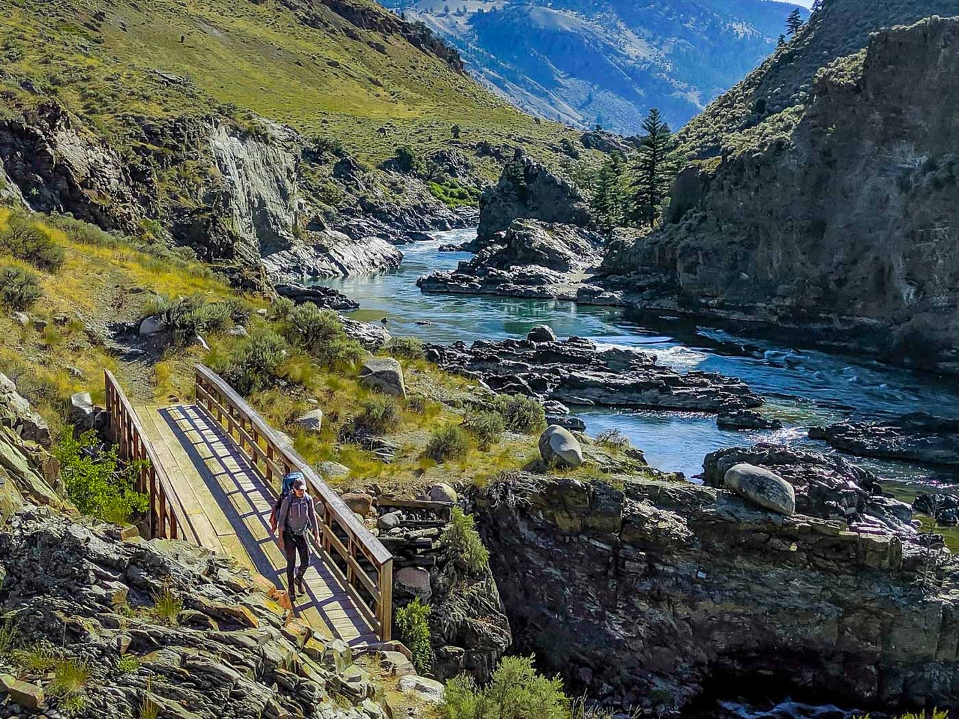
Bechler Falls (really a cascade) is a popular destination. Every outfitter does guided hiking, backpacking, llama and horsepacking trips to the Bechler River and Falls. Those trips leave from the Lone Star Trailhead on Grand Loop Road. You can make an easy level scenic day hike here, a triangle beginning and ending at Cave Falls with Bechler Falls and the Ranger Station at the corners. But, reaching Cave Falls is a major effort. The easy route is Grassy Lake Road which becomes Ashton Flagg Road, beginning at Flagg Ranch Information Station south of the park's South Entrance. This road is accessible only by four wheel drive high clearance vehicles. It's 2.5 hours this way. The alternate is route 20 south from West Yellowstone to Ashton, Idaho, Route 47 east, then Green Timber Road which becomes Cave Falls Road. If you're staying at Old Faithful Inn this is a three hour drive.There's a campground on Cave Falls Road about a mile from the Falls, so you can drive over, camp, do the hike, then drive back. This hike is best done in August, when mosquitoes and mud are gone. The trail leads through open wildflower filled meadow, deep forest, and along Bechler River. Cave Falls is impressive and there are other falls or cascades along the route. Carry bear spray and air horns and hike in groups of at least four. Also bring mosquito netting or bug spray. |
|
|||
|
